
Bryan Neighbors by Block Source
A Bryan neighbor search works best when it distinguishes the map from the record. An address point places a location. A parcel layer shows mapped property geometry. An appraisal record supplies public property context, and a deed may document a transfer. Historic directories, maps, and civic boundaries add time or community context. None of those sources alone proves every person associated with a block, so the source type should stay attached to each finding.
| Source | What It Shows About a Block | Access |
|---|---|---|
| City Address Management MapServer | Address points, properties, streets, ZIPs, subdivisions, city limits, historic districts, council districts, and MHP lots | Public REST service with JSON, GeoJSON, and PBF responses; maximum record count 1,000 |
| CitizenServe MapServer | BCAD parcels, boundaries, zoning, flood zones, historic districts, variances, conditional-use locations, and service areas | Public map service; live field-level query behavior needs confirmation |
| BCAD property search | Public owner display, property and geographic IDs, subdivision or neighborhood, and tax-year context | Public search by street number and street name |
| County Clerk land records | Deeds, plats, easements, liens, releases, and legal-description history | PublicSearch, clerk counter, and historic microfilm |
| City historic imagery and Sanborn maps | Visible site changes, building footprint, materials, use, and block layout | City GIS, Library of Congress, and local repository holdings |
| NAPP and neighborhood map context | Association name, approximate boundaries, district, and civic priorities | City program and form; not a complete resident list |
For Bryan neighbors, a public property name relates to a parcel rather than every individual at the address. A directory entry, a voter record, and an address point have different scope and different confidentiality rules.
Bryan GIS Layers Define the Block
The City of Bryan GIS is the first map source for an address, property, street, city limit, historic district, neighborhood, cemetery, zoning, or imagery question. Its Address Management service lists Address Points, Properties, Streets, Bryan Subdivisions, Bryan City Limits, Brazos ZIP Codes, Historic Districts, council districts, public-safety boxes, enterprise zones, and manufactured-home-park boundary and lot layers.
The documented viewer method is limited and clear: zoom to the location, turn on relevant layers and legends, browse the map, and inspect the address or property layers. Text inspection did not verify a click-adjacent command, a buffer or radius feature, a parcel-select control, or a measurement workflow. Do not assume any of those controls exist until the live viewer is tested. The service’s 1,000-record ceiling is a response-size limit, not a Bryan neighborhood limit.
The Address Management MapServer is the official service behind those address and property layers.
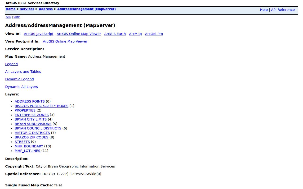
A layer can establish geographic context for Bryan neighbors, while title and identity questions still need a record from the appropriate custodian.
City and county mapping disclaimers also matter. Their maps are general reference tools, not legal boundary or survey evidence. Record a query date, visible layer, scale, and disclaimer before relying on a mapped relationship. The same address can have a changed street name, a parcel split, a merged tract, or a different mailing designation in another record system.
Map a Bryan Block With Records
Start from one specific Bryan address, define whether “nearby” means a shared boundary, a mapped address point, a street-facing property, or a subdivision block, and retain that definition with the search. The workflow then moves from map context to property validation. A street address is not a legal description, and a map is not a title opinion or survey.
- Bryan GIS address: locate the address, enable the address and property layers, and record the visible layer names, map date, and address context.
- Parcels and properties: identify the mapped properties that fit the chosen block definition. Do not claim a precise adjacency relationship unless the live map exposes evidence for it.
- BCAD validation: use BCAD with Street Number and Street Name. When the parser has trouble, BCAD instructs users to omit prefixes, suffixes, and unit numbers from Street Name. Save the property ID, geographic ID, public owner display, subdivision or neighborhood, and tax year.
- Deed validation: search Brazos land records with the street, subdivision, legal description, nearby owner names, and a date range. Separate deeds, liens, releases, easements, plats, and probate material because they answer different questions.
For a full named-street record chain, the Bryan street directory follows the address-based workflow in more depth. The block method stays narrower: map definition first, then parcel and instrument confirmation.
Bryan Neighborhoods Are Civic Context
The Neighborhood Association Partnership Program helps groups describe boundaries using roads, natural features, and city maps. Its registration form records an association name, general location, approximate boundaries, single-member district, purpose, meeting details, priorities, and neighborhood-plan interest. It is a civic-organization record, not an address directory or a source for publishing contact fields.
| Civic context | What can be used | Required caution |
|---|---|---|
| Carver-Kemp, East Side Historical District, and Downtown | Historical neighborhood names from the city’s 2013 plan | Confirm current status and boundaries through NAPP or city communications |
| North Oakwood, Milam-Jones, and Upper Burton Creek | Community and historic-location context | Do not treat a historical-plan listing as a current association roster |
| Westwood Estates and other listed areas | A lead for current boundary research and city district context | Association contacts are not proof of who is connected with every address |
The 2013 Community Wildfire Protection Plan also lists many other neighborhood and association names. Its historical list is valuable for a Bryan place-name search, but current boundaries and participation require verification.
The city’s NAPP program provides the current official starting point for that verification.
Association boundaries can explain civic context around a Bryan block without identifying a complete set of neighbors.
Several local repositories can add historical context without becoming a neighborhood roster. Carnegie holds local archives and directories, while Cushing finding aids point to community histories, maps, oral histories, and city-record material. A historical directory listing or oral-history mention is a lead that requires its own date, repository reference, and independent check.
Bryan Voter Data Is Not a Block Roster
Brazos County Elections maintains the county voter roll, but a county registration result does not establish a Bryan city address. County precinct, city limit, residence address, and mailing address are separate geographic concepts. The public route uses VoteTexas verification by Texas driver-license number when provided, VUID, or first and last name. Participation information does not reveal a ballot choice.
Texas confidentiality rules protect driver-license or state-ID details, Social Security information, telephone data, and certain voter-address information. Protected voters and Address Confidentiality Program participants may use a substitute address or have specially handled information. An address shown as asterisks, a substitute location, or no address is a protection feature, not an error to solve.
Note: A voter data question should stay within the lawful public output and should never be used to reconstruct a protected address.
Bryan Neighbor Sources Compared
Official records and commercial neighbor tools have different limits. A public custodian’s result is tied to a known record class and access rule. A commercial category may combine public filings, marketing data, and inferred links, which can be broader but less accurate than the Bryan custodian’s own record. Neither category turns a missing result into proof that a person has no connection to a block.
| Source category | Useful for | Limit to keep in view |
|---|---|---|
| Official GIS and property records | Address, parcel context, public owner display, legal-description leads, and source date | Maps are not surveys or title opinions; an owner display does not prove current presence |
| Official deeds and plats | Recorded transfer, parcel creation, easement, release, and legal-description history | An instrument may not identify every person connected with an address |
| Commercial neighbor tools | General discovery leads that require independent verification | May contain stale, inferred, or mismatched links and do not override protected information |
Bryan Blocks Change Over Time
Historic imagery can make a Bryan block easier to interpret. City GIS lists imagery years from 1936 through 2024. Sanborn maps add building footprints, materials, use, and block layout, but ordinarily do not name an owner or other person. The Library of Congress Bryan sheet from 1950 is a useful visual anchor, while Carnegie and Texas A&M holdings supply older local map leads.
Freedman Town/Hall’s Addition, Eastside, Downtown, and North Oakwood appear in city historical material, yet historical labels and current GIS boundaries should not be treated as the same thing. Preserve the map date, layer, scale, and source when comparing a past block with a present address.
Respect Privacy When Finding Neighbors
Texas public-information access is governed by the Texas Public Information Act, Tex. Gov’t Code ch. 552, alongside record-specific confidentiality rules. Ask for the smallest set of public information that answers the question, seek redacted copies where appropriate, and preserve the custodian’s explanation of an exception. Do not combine names, addresses, dates of birth, property, voter, court, cemetery, and other data into a single profile unless every field is necessary, lawfully public, and identity-confirmed.
Texas Address Confidentiality Program participants may use a substitute address and mail-forwarding service in voter, driver, vehicle, school, and court contexts. The Secretary of State’s voter-confidentiality guidance explains that an ACP voter address is not entered in the ordinary county system. Never try to fill in a protected location with GIS, property, or historical material.
Lawful use. Bryan neighbor research can support civic context, family reconnection, and personal curiosity. Do not use records or map data to stalk, harass, intimidate, threaten, or harm anyone.